From Memphis, we drove into Mississippi, the fifth state we’ve visited on this trip. We travelled south on surprisingly nice roads to connect with the Natchez Trace Parkway. The parkway, managed by the National Park Services, roughly follows the Natchez Trace Trail, a pathway used by Native Americans for centuries.
The parkway is a popular drive for RVers and features many free campgrounds along the way. We stopped at the southern most campground, Rocky Springs, about 20 minutes outside of Vicksburg, Mississippi.
The campground is dry camping — meaning no water, electric or sewer hookups — although there is a restroom onsite. However, there is no potable water available, and I had neglected to fill our fresh water tank back in Memphis. Soon after arrival, we drove off in search of water. There weren’t any park sites nearby with water, but we found a gas station that allowed us to fill our five-gallon jug of water from their sink. We could then pour that water through a fresh water fill port into our trailer’s storage tanks. Mostly that water would be used for washing dishes and flushing the toilet. We had bottles of water for drinking and cooking.

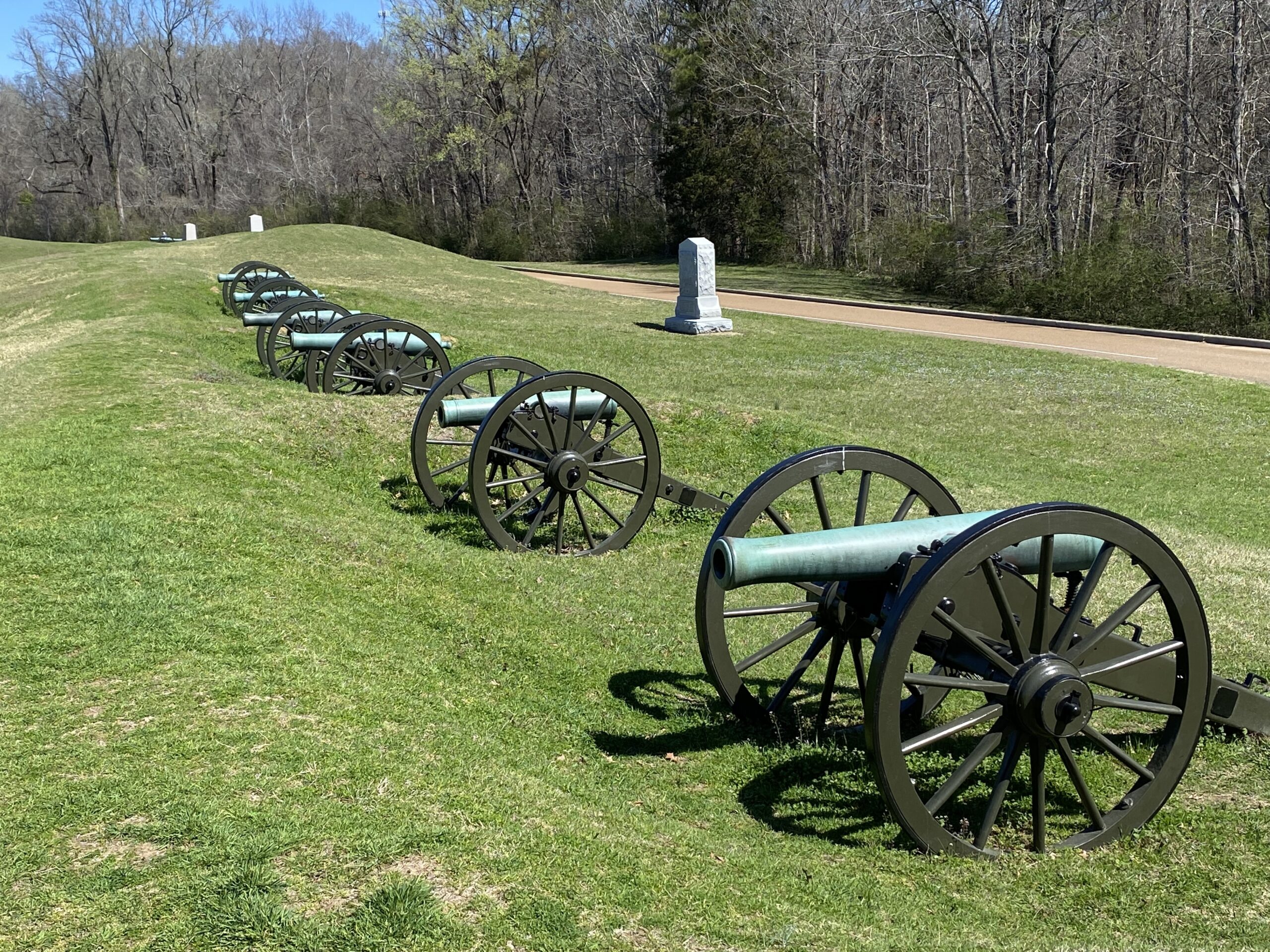
The following day we set out for the Vicksburg Military National Park, the site of one of the more interesting campaigns during the Civil War. The south used fortifications above the city of Vicksburg to control traffic on the Mississippi. That made it a key site for Union forces to capture so they could essentially split the Confederacy in two, and prevent the outflow of goods and the inflow of guns and ammunition.
The confederates had spent months fortifying their position, and after multiple unsuccessful attacks the Union army settled in for a long siege. The confederates held out for 40 days, but surrendered when their supplies ran out.
The park does a nice job explaining what happened there. A movie in the visitor’s center shows the history, and then visitors can drive a four-mile loop through the park to see where those events occurred. We downloaded the NPS app, which provided commentary at various stops along the route. What was most striking to us was how close the two sides were to each other during the attacks and the siege. It was so close that soldiers from opposite sides would banter with each other in between skirmishes.

The site also houses the remains of the U.S.S. Cairo, an iron-clad Union battleship that had been sunk by a mine in the Yazoo River just outside of Vicksburg in 1862. The boat sank quickly along with all of its supplies and the possessions of the sailors aboard.
Protected by a cocoon of silt and mud, the Cairo became a time capsule with her contents preserved in a largely oxygen-free environment. Nobody was quite sure where the boat had sunk, until she was rediscovered in 1956 and then raised, in three sections, in 1964.
The ship’s remains were moved to the park, with an overlay that provides an idea of what the boat looks like. Artifacts from the boat are on display in the museum next to it.
I had come down with some sort of head cold, so after the battlefield tour we went on a quest to find soup. We happened upon a Cajun restaurant called The Gumbo Pot, and a steaming bowl of their house special gumbo hit the spot.

After lunch, we ventured into downtown Vicksburg to visit the Biedenharn Coca-Cola Museum. The building dates back to 1890 and was originally a wholesale candy company and a shoe store. A few years later, the company became the local supplier of Coca-Cola syrup. The syrup was mixed with carbonated water on the spot at soda fountains for each customer. In 1894, Joseph Biedenharn came up with the idea of bottling the drink so it could sold elsewhere. He sent a case of the bottled Coca-Cola to the company’s owner, who gave his blessing for the operation. The rest, as they say, is history.
The museum itself is pretty small, with some historic items from the early days of Coca-Cola, and then a lot of Coke-themed paraphernalia and bottles from the past century. They sell Cokes and other soft drinks there, as well as ice cream. We thought of getting a Coca-Cola float, particularly as part of the proceeds from every float went to support the war effort in Ukraine. But the line of people ordering was long and we decided to skip it.

We had planned to stay a third night at the Rocky Springs campground and to do a day trip to Poverty Point, Louisiana. But the campground wasn’t the nicest — sometimes you get what you pay for — and staying another night would have left us with a long drive to our next destination.
Instead, we opted to move to the Poverty Point Reservoir State Park. Fortunately, the park had plenty of open spots and offered hot showers!
It was just a short hour-and-a-half drive there, but would cut our drive time for the next day by at least an hour. After setting up the trailer, we headed to the Poverty Point World Heritage Site. Poverty Point gets its name from a 19th century plantation that operated there, but the true attraction is an earthen mound site built by Native Americans 3,400 years ago.

The mound builders carried nearly 2 million cubic yards of soil one basket at a time to build a 72-foot mound and a series of concentric arc ridges. The entire complex amounted to a city in northern Louisiana around the time Queen Nefertiti ruled Egypt. The site is a great reminder that American history didn’t start with Columbus or the Pilgrims. This was an advanced group of hunter-gatherers that came together to build a highly organized society. Yet, we had learned nothing about this in school.
Once again we started with a movie in the visitor center, which is really our favorite way of exploring new sites. The complex offers a guided tram tour and a driving tour, but we opted for a 2.5-mile walking route instead. A free guidebook provides information to read at about 20 signposts along the way.

The concentric arcs, where the residents of the city built their huts, were a bit hard to see, but the park lets the grass grow a little higher on the ridges to improve visibility. The mounds are much more prominent and you can climb to the top of the largest one. Three mounds are aligned perfectly along the north-south axis, and inline with an older mound build in the vicinity by the tribe’s ancestors. The visitor center also displays many of the archeological finds from the site.
Days: 56
Miles Traveled: 7960
Next stop: Hot Springs National Park

